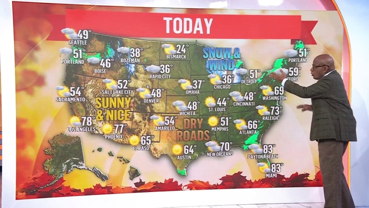
Cold, wintry weather and strong winds are expected in large parts of the country Wednesday and into Thursday as millions hit the roads and take to the skies ahead of Thanksgiving.
Up to 2 feet of snow is set to hit the Upper Midwest and 52 million people are under wind alerts from the Plains to the Great Lakes and into the Appalachians, including in major cities such as Chicago and Detroit. For the areas under those alerts, gusts are forecast to be as high as 60 mph.
Blizzard warnings are in effect for 13 million people and cover parts of northern Wisconsin and the Upper Peninsula of Michigan, and areas east of lakes Erie and Ontario are under lake-effect snow warnings. Significant snowfall has begun, and blizzard conditions are developing as cold air pours in behind the system.
For northern Wisconsin and northern Michigan, up to 3 feet of snow is possible. For the areas downwind of lakes Erie and Ontario, 20 inches is possible. The storm will grow as it moves east, dumping what could be more than a foot of snow over the Snow Belt along the south shore of Lake Superior.
Farther south and east, rain will gradually change to snow by Thanksgiving morning, with additional lake-effect bands setting up through Friday, especially downwind of the lower Great Lakes.
A major lake-effect snowstorm is expected through Saturday, in which snowfall rates of 1 to 2 inches per hour, combined with wind gusts stronger than 30 mph, will lead to nearly impossible travel conditions.
Wet and snowy weather will also take over the Pacific Northwest — including Seattle and Portland, Oregon — and showers and storms are plaguing cities along the Interstate 95 corridor Wednesday.
Temperatures are mild across the East Coast on Wednesday, though, before colder air sweeps over the region Wednesday night as a strong cold front pushes through. It will exit into the Atlantic on Thursday, bringing clear skies but leaving behind gusty winds and cool temperatures.
A windy day could affect the famed Macy's Thanksgiving Day Parade in New York City. Balloons may be flying lower because of wind gusts up to 35 mph.
By Friday morning, polar air will settle across the central and eastern United States, dropping temperatures to the freezing mark as far south as the Florida Panhandle, though New England will still run milder than typical for late November.
Meanwhile, the Western United States will stay milder than normal through the Thanksgiving holiday. The Pacific Northwest can expect periods of mountain snow and lower-elevation rain as a couple of Pacific systems move onshore.
By Friday morning, snow chances will increase across Montana, where an upslope snow event may develop under arctic high pressure to the north and a strengthening low over the central High Plains.
Thunderstorms in southern Texas early Thursday should gradually diminish as a cold front continues moving southward.
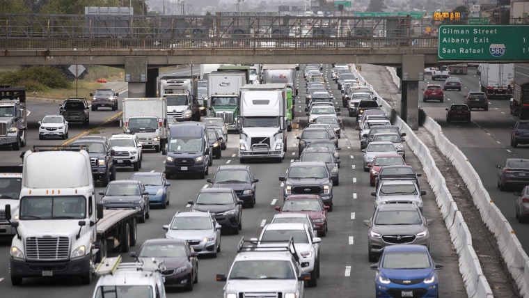
Bad weather is already causing disruptions as millions hit the road in what is supposed to be a record-setting travel day this Thanksgiving eve.
Semitrucks rolled off roads in Minnesota, blocking traffic. In North Dakota, a car slid off an icy and snowy road.
About 73 million people are expected to travel by car to their Thanksgiving destinations — about 1 million more than this time last year. That number could be even higher than the current prediction if people were deterred from traveling by plane because of flight disruptions stemming from the government shutdown.
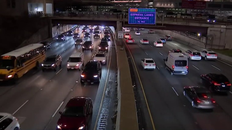
Traffic was already at a standstill approaching the George Washington Bridge heading into New York City early Wednesday.
If drivers want to hit the lower traffic sweet spot, they should drive before 11 a.m. or after 8 p.m. Wednesday, avoiding the middle of the day. The same goes for Sunday, when everyone is set to travel back home after the holiday.