Last weekend’s winter storm may have covered much of the country in a glut of snow and ice, but the season has not delivered out West, where several states face a snowpack drought.
In Colorado, the snowpack is “the lowest on record for this point in the season,” said Peter Goble, the assistant state climatologist. “All of our mountain ranges are well below normal.”
It’s the same story in Utah.
“We’re in uncharted territory right now, and we’re headed toward the lowest snowpack we’ve ever had on Feb. 1,” said Kevin Perry, a University of Utah atmospheric scientist.
Given those conditions, scientists are growing concerned about the water supply and a risk of wildfires later in the year. Because the mountain snowpack in Western states runs off as water throughout spring and summer, the levels influence how much water farmers can use to irrigate crops, how risky the wildfire season will be, and how much electricity hydropower dams can generate.
Measurements of Western snowpack come from the National Resources Conservation Service, which collects data from more than 800 high-elevation monitoring stations in the mountains. The service tracks how much water is in the snowpack at more than 80 basins in the Western continental United States, and its data shows that all but a handful are trending well below average.
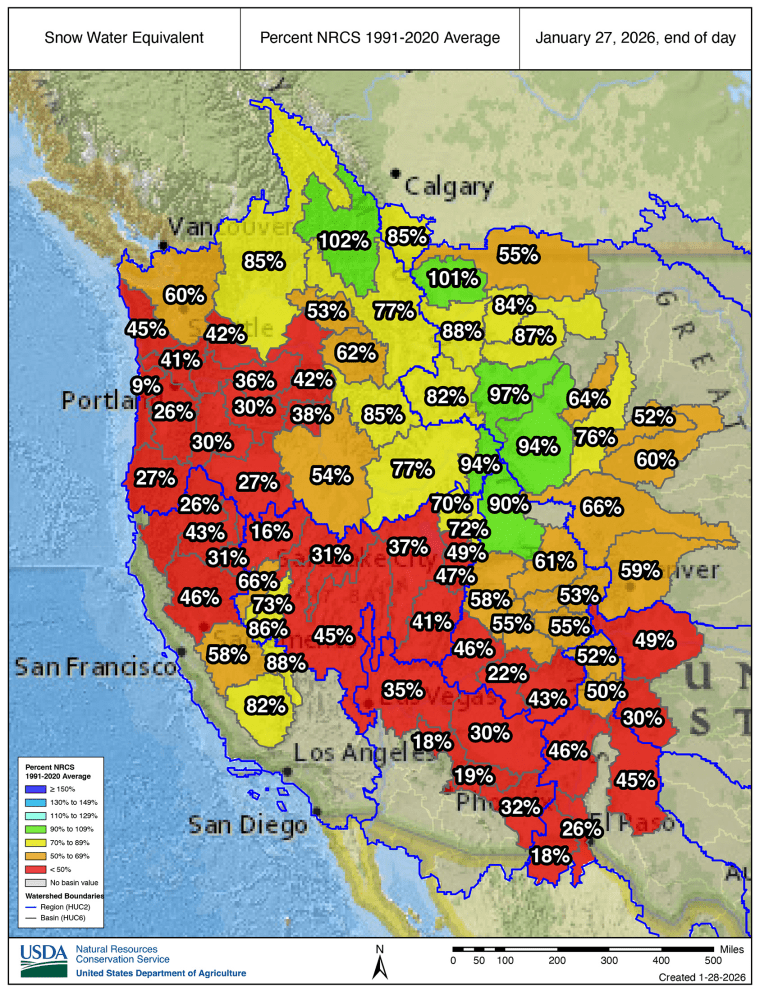
While it’s not unusual to have some basins lower than historical averages, it’s rare to have nearly every region of the West facing snowfall deficits.
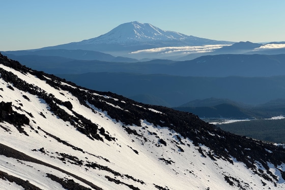
In Washington state, a mid-January climb of Mount Saint Helens revealed conditions that felt more like June than midwinter, with large patches of volcanic rock exposed near the crater rim.
The reasons for the snowpack drought vary by region, but across the West, temperatures have been uncommonly warm this winter, which has led more precipitation to fall as rain instead of snow. That was true when atmospheric river storms hammered the Pacific Northwest in December.
“Washington, Oregon, California and many Western states had their warmest December ever on record, and so the torrential rains that we had with the atmospheric river and the flooding and damage from too much water — none of that stayed in the mountains,” said Philip Mote, a professor at Oregon State University’s College of Earth, Ocean, and Atmospheric Sciences.
Then this month, the spigot of moisture largely shut off in the Northwest.
In Utah, early season rainfall in November and December melted everything below about 9,000 feet of elevation, leaving the Wasatch mountains looking top heavy, according to Perry.
“The high elevation snowpack is actually really good,” Perry said. But “we just have no low elevation and very little mid-elevation snowpack.”
Colorado has simply remained relatively hot and dry.
“December of 2025 was nine degrees warmer than average statewide, which was our warmest on record, going back to 1895,” Goble said.
The snowpack in California — known for its boom and bust water cycle — is in better shape, particularly in the southern Sierras, where several basins have above-average accumulations.
But for the regions left wanting for snow, little relief is expected soon.
The National Oceanic and Atmospheric Administration’s Climate Prediction Center expects dry conditions for much of the West for the next two weeks, with temperatures remaining above average for the next month.
